State Symbols of Meghalaya
Last updated on January 21st, 2023 by Editorial Staff
By | Updated on January 21, 2023
Reviewed by Rittika
Meghalaya is a hilly state in northeastern India and one of India’s eight Northeastern states. In Sanskrit, Meghalaya means “abode of clouds,” which lives up to its moniker. It is known for its lush forests, heavy rains, and diverse biodiversity, making it one of the top places to visit in Meghalaya.
Meghalaya is bordered in the Northeast by Assam and the south by Bangladesh. Previously, Meghalaya was a part of British Assam. The Khasi and Jaintia (sometimes referred to as Khasi-Jaintia) and the Garo are the state’s most powerful ethnic groups. These three communities have been merged into one administration for political reasons, but the Khasi-Jaintia and Garo have had diverse histories and complex experiences.
The state has Assam towards its north, on the south by Bangladesh. Shillong, sometimes known as the Scotland of the East, is the capital. Shillong is home to 354,324 people. Overall, the population amount to approximately 2,175,000 in the city.
History
The present-day state of Meghalaya is the result of the Khasi and Jaintia Districts, the Khasi States, and Garo Hills, which are populated primarily by the Khasi, Jaintia, and Garo ethnic groups. It was included in the old Assam’s Sixth Schedule of Tribal Areas.
The Khasis, Jaintias, and Garos have a variety of myths, rituals, and findings. According to legend, Khasis were the first immigrants to make their way across northern Myanmar to Khasi in East Assam’s plains, where they established a new stronghold. Until the British authority took over in the 19th century, the Khasi, Garo, and Jaintia tribes had their kingdoms.
The British eventually incorporated it. In 1835, Meghalaya was annexed by Assam; however, the state was later given its independence in 1947. Assam has an autonomous status. Meghalaya, on the other hand, was dissatisfied with the arrangement and began a constitutionally-guaranteed peaceful pursuit for greater independence. When Assamese became the official language, their campaign was a watershed moment. The tribes of Meghalaya were not acquainted with this language. The Centre was aware of their predicament and sympathized with them similarly. They realized that Meghalaya was eligible for their state.
Meghalaya was established as a full-fledged state in 1972. Meghalaya’s state is divided into 11 districts. East Garo Hills, North Garo Hills, East Khasi Hills, Jaintia Hills, East Jaintia Hills, Ri-bhoi, South Garo Hills, West Garo Hills, South West Garo Hills, West Khasi Hills, and South Khasi Hills are all part of the Garo hills.
Government
Like other Indian states, Meghalaya has a governor the Indian president selects. An elected Legislative Assembly appoints a Council of Ministers, led by a chief minister (Vidhan Sabha). The Shillong High Court leads the state’s judiciary and 11 administrative districts in the state.
The current Meghalaya Legislative Assembly is unicameral, with 60 legislators (M.L.A). Since 1970, Meghalaya has had twelve different Chief Ministers. Six belonged to the Indian National Congress, including Williamson A. Sangma, the first president. Since March 6, 2018, Conrad Sangma of the National People’s Party has been the governing party.
Climate, Flora, and Fauna
Meghalaya has a humid subtropical climate (between hot and cold). Because of the high annual rainfall of 1200 cm, this state is known as the “wettest” in the country. Cherrapunji, located south of Shillong, has broken the global record for the most rain in a calendar month.
The town of Mavasinram, near this city, holds the record for the most annual rainfall. About a third of the state is wooded, with the state’s largest peaks being the Garo, Khasi, and Jaintia hills. As a result, the Meghalayan forest is one of Asia’s most botanically diverse environments.
Cultural life
Many people from the Khasi, Jaintia, and Garo communities have converted to Christianity, and churches, temples, mosques, gurudwaras, and monasteries scatter throughout Meghalaya. Meghalaya has a diverse tribal cultural background. One of the distinctive elements of the people’s culture is their matrilineal system, which traces genealogy and inheritance through women.
Dance is an essential aspect of the people’s culture in Meghalaya, particularly among the Khasi. These dance genres portray an individual’s or a village’s or a combination of villages’ history or life cycle. These dance traditions differ in style according to place, but they all depict a global culture. The residents of this community participate in a variety of festivals, including
Ka Shad Suk Mynsiem, Ka Pom-Blang Nongkrem, Ka-Shad Shyngwiang-Thangiap, Ka-Shad-Kynjoh Khaskain, Ka Bam Khana Shnong, Umsan Nongkharai, and Shad Beh Sier are some of the festivities that this village celebrates. According to the Jaintias, cultural festivals are held to promote harmony between man, his culture, and his natural surroundings, or ecosystem. People also believe that celebrating festivals brings people together and creates a positive atmosphere in the community.
Places to Visit
Meghalaya will astonish you with the variety of things it has to offer. Meghalaya, a pine-fresh mountain state in the Northeast, encapsulates beautiful green valleys and forests.
Cherrapunji: Cherrapunji is one of the wettest places on earth since it receives the most rainfall. Foreigners flock from all over the world to see the Dain-Then, Kynrem, and Nohkalikai waterfalls, recognized as Cherrapunji’s famous waterfalls. It is also home to some of the mesmerizing waterfalls of Meghalaya.
Elephant Falls: The forested state of Meghalaya is also noted for its spectacular waterfalls, which are found throughout the state. Elephant Falls, Meghalaya’s natural wonder, features an elephant-like stone at its base. Visiting this spectacular waterfall in the North-East is a must when in Meghalaya.
Double-decker Living Root Bridge: It is a double-decker living root bridge in Cherrapunji, Meghalaya, and famed for its bridge formed from the roots of an Indian rubber tree. The bridge spans 3 kilometers and rises to a height of 2400 feet. It’s the most picturesque when the Umshiang river runs beneath the bridge, and you’re walking over it. It is the world’s oldest natural bridge, built roughly 200 years ago, although it can barely hold 50 people at a time.
Mawlynnong Village: The Mawlynnong settlement, to be precise, is Asia’s cleanest village. It is one of the fascinating places to visit in Meghalaya during the day. This village has all gorgeous waterfalls, root bridges, a clean environment, and a scenic outlook.
Mawsmai Cave: Mawsmai Cave is the most beautiful of all the caves in the area. There is a lot of foliage to look at within the cave. The cave is about 150 meters long, which is not the longest when compared to other caves in the vicinity, but it does offer a view into underground life. Mawsmai Cave, located in Meghalaya’s East Khasi Hills, is only 6 kilometers from the center of Cherrapunjee.
Umiam Lake: Umiam Lake is a gorgeous manmade reservoir located 15 kilometers north of Shillong. The lake formed because of the building of a dam to generate hydroelectric power. The lovely Umiam Lake is flanked by lush green East Khasi hills, giving outdoor enthusiasts with an all-encompassing panorama.
Dawki: Dawki doesn’t need a preface. It is one of Meghalaya’s most prominent tourist destinations. Dawki is one of the most eye-catching sites on the planet, thanks to its crystal-clear river. So if you’re planning a trip to Meghalaya anytime soon, Dawki should be on your list. It is also a key trade hub because it is wedged between India and Bangladesh.
Laitlum Canyon: Laitlum Canyon, located in the East Khasi Hills, is certainly a paradise. This dreamland is one of Meghalaya’s most beautiful tourist destinations, with low-flying clouds, sweeping green landscapes, and breathtaking views.
Mawsynram: Mawsynram is the wettest of all the tourist destinations in Meghalaya. This community, surrounded by lush green hills, receives massive amounts of rainfall throughout the year. As a result, beautiful vistas, low-flying clouds, foggy weather, and soothing waterfalls decorate the village.
Mawphlang Sacred Forest: Mawphlang Sacred Forest is a tropical rainforest in Meghalaya’s Nongrum district, home to flora and fauna. This forest is surrounded by towering trees that are over 1000 years old. This forest’s greenery shows Meghalaya’s natural magnificence. The local population also regarded the sacred forest because of its legendary significance.
State Information
| Official Language | English |
| State Rank | 22 |
| Demonym(s) | Meghalayan |
| Nickname | Scotland of East |
| ISO | IN-ML |
| Formation Date | 21 January 1972 |
| Coordinates | Lat: 25.4670° N, Long: 91.3662° E |
| Area |
State seal
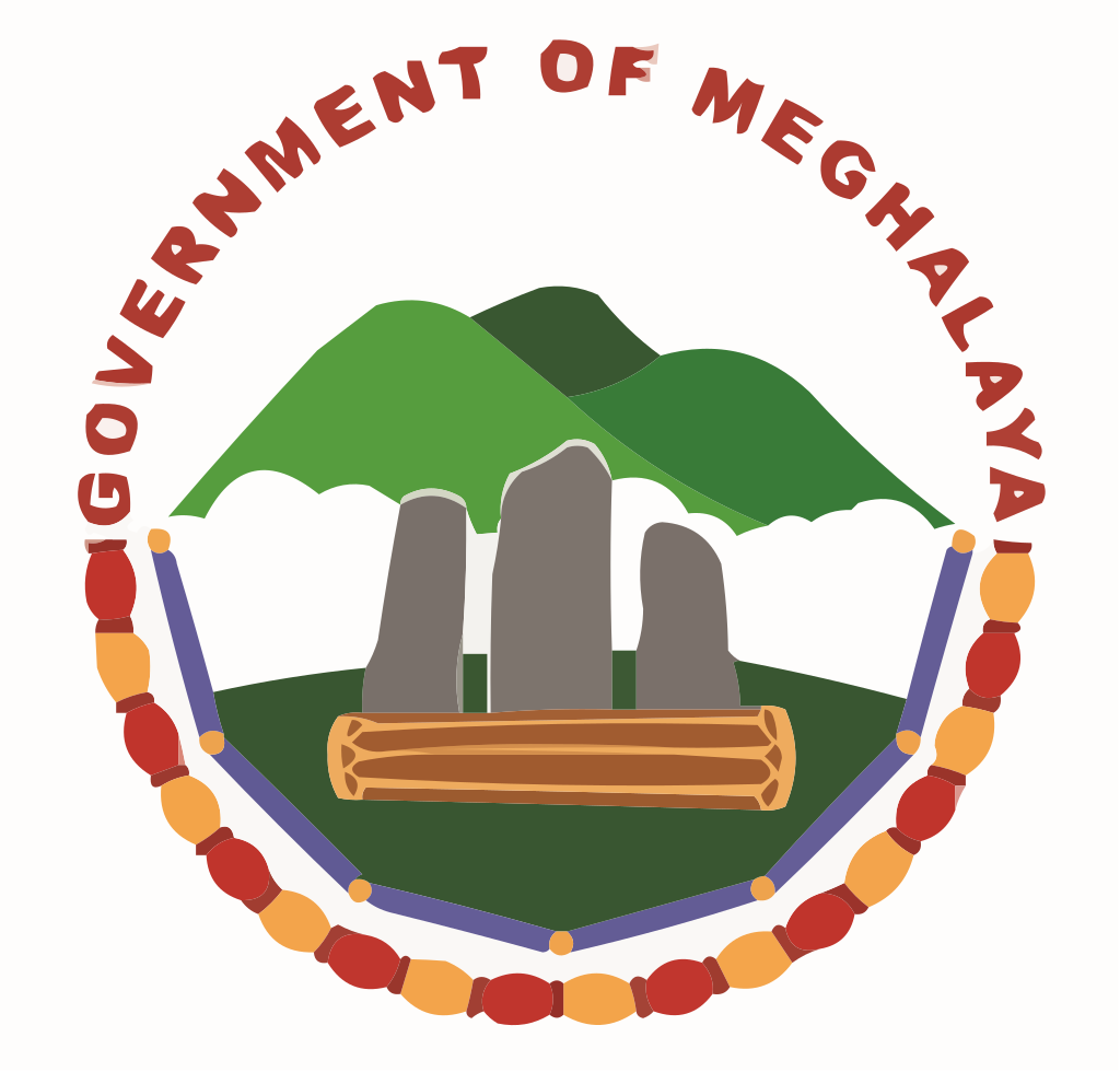
Motto of Meghalaya
Satyameva Jayate-"Truth alone triumphs"
State symbols of Meghalaya 👇
-
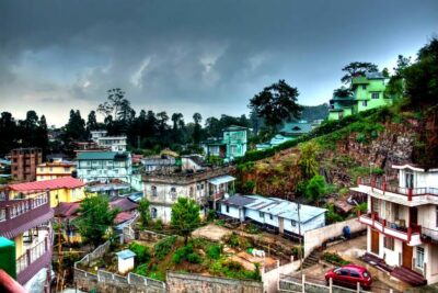
 State capitalShillong
 -
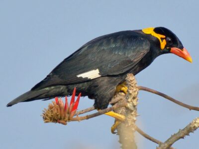
State birdHill myna
-
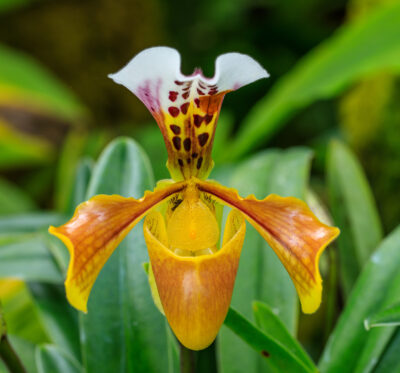
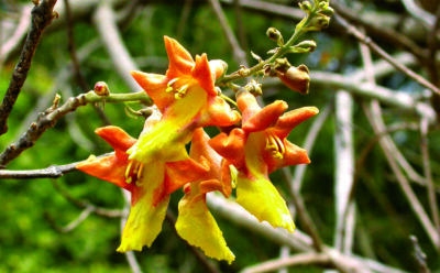
State flowerLady's Slipper Orchid
-
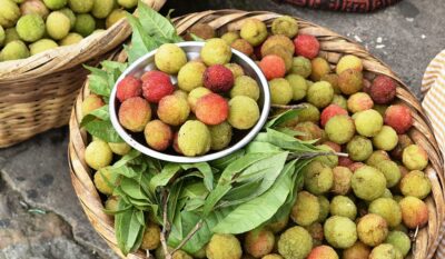
State fruitSohphie
-
State treeGamhar
-
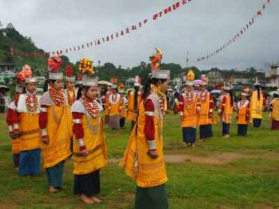
State danceShad Sukmysiem
-
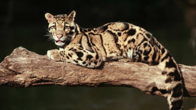
State animalClouded leopard
-
State dishJadoh rice (unofficial)

State location
Guess the Flags Quiz


Sharing is caring 🤗
State Flag of Meghalaya
