State Symbols of Manipur
Last updated on January 21st, 2023 by Editorial Staff
By | Updated on January 21, 2023
Reviewed by Rittika
Manipur is one of India’s 28 states, located in the country’s northeast corner. Pandit Jawaharlal Nehru, India’s first Prime Minister, correctly referred to Manipur as the “Jewel of India.” Manipur is noted for its illustrious history, diverse flora and fauna, and diverse cultural heritage. In addition, Manipur is the home of the game of Polo and the world’s only floating National Park.
Popular sports personalities and Olympic medalists Mirabai Chanu and Mary Kom also hail from this region.
History
The term Manipur means “land of gems.” Manipur became a princely kingdom under British control in 1891 and remained an independent princely country until 1947. On September 21, 1949, the king signed the Manipur merger agreement. The Indian government declared the formal annexation of Manipur on October 15, 1949, following the conditions of this agreement. The Manipur state assembly and council of ministers, which were elected by the people of Manipur using the Universal Adult Franchise under the terms of the Manipur Constitution Act 1947, were forcefully abolished on the same day by executive order of the Indian government. Manipur was the site of numerous severe clashes between Japanese and Allied forces during World War II.
The state has a total size of 22,347 square kilometers and a population of 2,721,756 people. The Meiteis, Nagas, Kukis, Zomis, and other smaller populations speak various Sino-Tibetan languages, and the state has a population count of around 3 million people. Additionally, the state is flanked on the north by Nagaland and on the south by Mizoram. Towards the west is Assam, surrounded in the east by Burma. Imphal is the capital of Manipur and Meiteilon is Manipur’s major official language. English is slowly gaining traction as a popular communication language. Migrants from northern India speak Hindi as well. The people enjoy a good standard of living in the county, with good physical facilities and a literacy rate of 79.85%.
Manipur’s state is divided into nine districts. Bishnupur, Churachandpur, Chandel, Imphal East, Imphal West, Senapati, Tamenglong, Thoubal, and Ukhrul are the names of the districts.
Physiography and Climate
Manipur is one of Northeast India’s eight states and one of the Eight Sister States. The capital is located in a 700-square-mile oval-shaped valley framed by blue mountains at an elevation of 790 meters above sea level. The valley’s slope runs from north to south. The mountain ranges function as a buffer to cyclonic storms emerging from the Bay of Bengal and blocking cold winds from the north from reaching the valley. Manipur’s climate is heavily determined by the topography of this mountainous terrain that characterizes the state’s geography.
The state of Manipur, which sits at an elevation of 790 meters above sea level, is surrounded by hills. This region of India is located in the northeastern part of the country. Although the winters can be a tad cool, the climate is generally pleasant. The atmosphere of the state is lush, with a mean annual precipitation of 933 millimeters in Imphal. Tamenglong has a rainfall range of 2593 mm. Temperatures range from below zero to 36 degrees Celsius.
Government
The governor is the state’s constitutional head, selected by India’s president. The governor governs on the recommendation of the elected chief minister and the Council of Ministers. The Vidhan Sabha (Legislative Assembly) of Manipur is a unicameral legislature with 60 members, and the state judiciary is led by the state’s High Court, based in Imphal. There are 16 administrative districts in Manipur.
Manipur was classified as a “C” (centrally controlled) state, then a Territorial Council, and finally a Union Territory when the Merger Agreement with the Union of India was signed. In 1972, it attained statehood for the first time. After 1948, Manipur conducted its next election in 1957, after which elections were held regularly until 1972, with Congress and a few Left-wing parties vying for power. During this time, Congress came to power regularly, despite divided mandates that resulted in multiple coalitions and short-lived governments.
The 2017 Assembly election marked a pivotal point in Manipur politics, as the BJP formed a coalition government to terminate Congress’s control in the state. After a 15-year reign, Congress could not secure a simple majority in the northeastern state while remaining the single largest political party. As a result, Nongthombam Biren Singh took the oath with eight ministers from various parties on March 15, 2017, and it was later expanded by adding four more ministers.
Cultural Life
Manipur is the birthplace of Manipuri, an indigenous type of traditional dance. Hand movements are employed artfully rather than pantomime, bells are not emphasized, and both men and women act communally, unlike other Indian dance genres. The best thing about Manipur dance is that it has preserved ancient and folk dances in addition to the Manipuri Dance. Aside from it, there are other dance genres such as the Khamba Thoibi, Maibi Dance, Nupa Pala, Raas Leela, and Pung Cholom.
Manipur is a land full of celebrations. Festivals like Lai Haraoba, Yao Shang, and Rath Yatra are widely celebrated. Apart from that, people like participating in sports. Polo and field hockey are two of the state’s most popular sports.
Rice, fish, and veggies are Manipur’s staple foods. Yongchaak singju, Monica gi chakum, Aloo Mattar and smoked fish, Bora, Kanghau, Aloo angouba, and Pakoura mah are some of Manipur’s most popular meals and preparations.
Manipur lists as one of the few Indian states where public drama (theatre) shows are held regularly. Manipuri Theater was founded as a development of traditional public performances and dance rituals into modern theatre.
Places to Visit
Imphal: What better spot to begin your adventure than in the state capital of Imphal? The city’s architecture reveals that the town was formerly the historic royal seat of the old Kingdom of Manipur. Imphal is known for its temples, markets, and beautiful natural scenery.
Kangla Fort: The historic Kangla Palace is just 800 meters from the state museum. It is a major tourist hotspot in the city, located on the banks of the Imphal River. Kangla Palace has a few temples on its grounds, demonstrating the religious influence on Manipuri culture.
Imphal War Cemetery: The Imphal War Cemetery is the next stop after Kangla Palace and Govindajee Temple. The Imphal War was one of World War II’s most important and bloody battles. Unlike the Kohima War Cemetery, the Imphal War Cemetery covers a large area. The Kangla Palace is three kilometers away from the cemetery, which is properly kept and accessible by foot.
Ima Market: There are a few more sites to visit in Imphal if the previous places haven’t overwhelmed you. The Ima Market, also known as Mother’s Market or Nupi Keithel in Manipur, is Asia’s largest women-run market.
Loktak Lake: Manipur’s most famous attraction is Loktak Lake, located 50 kilometers south of the city of Moirang. Loktak Lake is northeastern India’s largest freshwater lake, and it is known for its diverse aquatic life.
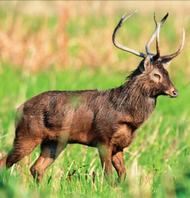
Kabul Lamjao National Park: Sangai Deer can be found at the Keibul Lamjao National Park, the world’s only floating national park. Sangai is Manipur’s state animal, and the state government hosts a Sangai festival every November that draws visitors from all across the region.
Manipur is home to a plethora of tourist attractions. Each place virtually speaks for itself in terms of its distinctiveness. Every tourist attraction in India is a source of pride for the country.
State Information
| Official Language | Manipuri |
| State Rank | 23 |
| Demonym(s) | Manipuri |
| Nickname | The Jewel of India |
| ISO | IN-MN |
| Formation Date | 15 October 1949 |
| Coordinates | Lat: 24.6637° N, Long: 93.9063° E |
| Area |
State seal

Motto of Manipur
State symbols of Manipur 👇
-
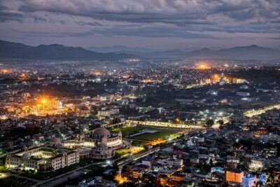
 State capitalImphal
 -
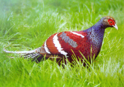
State birdNongyeen
-
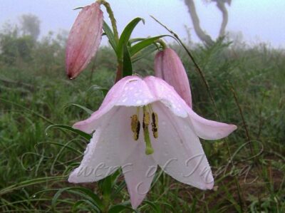
State flowerShirui lily
-
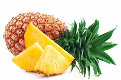
State fruitPineapple
-
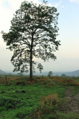
State treeUningthou
-
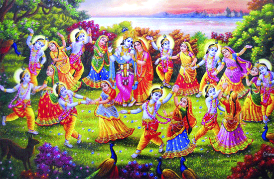
State danceThe Raas Leela
-
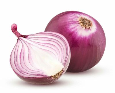
State vegetableOnions
-
State animalSangai
-
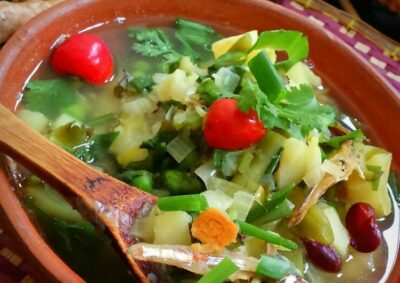
State dishChamthong or Kangshoi
State location
Guess the Flags Quiz


Sharing is caring 🤗
State Flag of Manipur
